Laguna: Cavinti Underground River and Caves Complex: Entrance Fee/Permit, Map, How to Get There
23 April 2013
UPDATED: April 2014
Travel Guide: Cavinti Underground River and Caves Complex
Tutubi knows how to get to Cavinti, either via public transportation or by private car, finding the site is not hard for him come his turn to actually visit the site. Other information will be posted once available and reviewed by his sources of information.
 |
| The poster of Cavinti Underground River and Caves Complex, good there are people on the image to add scale |
Travel Guide: Cavinti Underground River and Caves Complex Tour in a nutshell:
1. Make a reservation for an entrance pass to the Cavinti Underground River and Caves Complex by contacting Cavinti Tourism office. Email advance booking/reservations to this email address: lgucavinti@gmail.com
Reservations are limited to 10 persons per group. Contact number and official website will be posted once available.
2. Confirm your permit to tour Cavinti Underground River and Caves Complex by getting your permit personally, though your authorized representative or package tour operator. You need to pay the entrance fee of PhP10.00/person (called environmental fee) Walk-in visitors are NOT guaranteed visitors entry permit. The visitors permit confirmation and payment can be paid at Cavinti Municipal Hall in weekdays and at Bumbungan Ecopark on weekends.
3. Go to Cavinti Underground River and Caves Complex on your reserved date. Bring proper identification cards (school ID accepted)
4. Enjoy the tour but do observe the rules posted at the site particularly do not touch stalactites, stalagmites and columns inside the Cavinti caves
 |
| a giant stalactite of Kwebang Puti (stalactites hang from the ceiling, stalagmites are on the ground, and a column occurs when the cave roof and floor are joined together |
 |
| The Laguna underground river has mini-waterfalls inside gushing with cold natural mineral water |
How to Get to Cavinti Underground River and Caves Complex
(Tutubi will create the map via OpenStreetMap once he gets to the place and will post waypoint/GPS coordinates later). An interactive map of Cavinti (helped updated by Tutubi with the cool guys of OpenStreetMap Philippines) can be found here where you can trace back to your origin and jump-off point.
How to Get to Cavinti, Laguna from Manila:
1.0 How to Commute by bus and jeepney
1.1 Commute to Sta. Cruz, Laguna by Bus
From Cubao Quezon City, take HM Transport or DLTB bus to Sta. Cruz, Laguna (Bus Fare via HM Transport is PhP148.50)
1.2 From Pasay, near LRT Gil Puyat station, take Green Star Express or DLTB bus to Sta. Cruz, Laguna
Bus fare:, travel time is around 3 hours. Bus fare via DLTB is PhP132.00 while via Green Star express is PhP140.50 (yes, DLTB is cheaper plus free Wi-fi Internet)
1.3 In Sta. Cruz, ride a jeepney to Cavinti and request the driver to drop you off at Bumbungan Eco-Park (fare is about PhP20.00, travel time about 40 minutes) which is near a bridge over Bumbungan River (the river that feeds Pagsanjan Falls)
2.0 Driving Directions to Cavinti, Laguna
from Quezon City, it's recommended to take the scenic Rizal route via Marcos Highway, Sumulong passing through the city of Antipolo, the Rizal towns of Teresa, Baras, Morong, Tanay, Pililla, and the Laguna towns of Mabitac, Famy, Siniloan, Pangil, Pakil, Paete, Kalayaan.
After passing by the elevated portion of Manila East Road in Kalayaan town, you will need to turn left and pass by Caliraya-Cavinti Road until you reach Bumbungan Eco-park. This route, from Trinoma, takes about 3 hours travel time.
From Makati or southern cities of Manila, take SLEx and exit at Calamba (toll fee: PhP218.00 class 1 vehicle), head towards SM City Calamba then turn right. Follow the highway passing through the towns of Los Banos, Bay, Calauan, Victoria, Pila, Sta. Cruz, Pagsanjan and Lumban. After passing Lumban Public Market (and a police checkpoint barrier), choose the right fork of the road going to Lake Caliraya. Continue until you reach Bumbungan EcoPark which is the jump-off point to Cavinti Underground River and Caves Complex
as of posting time, Pagsanjan Bridge near Pagsanjan Municipal Hall is under construction, you need to take the alternate route to Cavinti via Lumban and Caliraya Lake thus the direction provided above.
3.0 To get to Cavinti Underground River and Caves Complex from Cavinti, you need to pay PhP1,000.00 fee (inclusive of transportation and lunch)
4.0 The final travel part of Cavinti spelunking adventure is a short bamboo raft ride (balsa) to cross the Lalangawan River to reach the cave entrance which is near the boundary of Cavinti, Laguna and Mauban, Quezon
Notes:
1. The road from Cavinti town proper going to the site is not paved, only 4x4 vehicles (for off-road) or jeepneys can traverse it.
2. Bring your own high powered flashlight or gas lamp as it's dark inside the caves
3. At present, this is still undeveloped, tourism facilities are inadequate, guides are ill-equipped, area is restricted to 50 tourists (non-Cavinti residents) but cave entrance fee is now at PhP1000.00/person with transportation and lunch
4. There's an underground river and waterfalls inside but most parts of the cave complex and chambers remain unexplored, wildlife (if there are animals, lizards, snakes, pythons, spiders) taking refuge inside not yet documented
4. There are hotels and resorts near Cavinti particularly Pagsanfalls resorts or resorts in Lake Caliraya for you to spend the night, wash yourself or overnight accommodations.
5. You can take a swim in the Lalangawan River with cold mountain water and huge rocks and boulders
This will be updated from time to time to remain fresh and current. Tutubi's planned tour of this new "place to see in Laguna" last April 20 didn't push through due to the new rule on reservation and with fully-booked place for tour bookings.
Labels: Calabarzon, Caves, Ecotourism, Laguna, Spelunking, Travel Guides
posted by GingGoy @ 9:00 PM,
,


Bohol: Ancient Cave Art (Red Hematite Rock Paintings) of Lamanoc Island in Anda
12 July 2012
Why is it mystical? Well, this place is a small island off the coast of Anda with ancient rock art in the form of red hematite paintings (the Angono Petroglyphs in Binangonan, Rizal is another ancient cave art), ancient cave dwellings, tombs and burial grounds, prehistoric human settlement (prehistoric, in Philippine historical context does not mean dinosaurs) and mystic practices mostly involving chicken in the rituals (called manok or manok, thus the name)

Lamanoc Island (or Lamanok Island in some travel journals) has the Bakhawan Mangrove Forest of Anda as gateway where you board a very small outrigger boats (banca) for for only three persons from Lamanoc Point to the "enchanted island" about a kilometer away.
 You can see one of the large wooden crosses (upper left of the photo) planted on the caves claimed by locals to drive away evil spirits
The first stop of the eco-tourism and historical tour is the ancient rock art in the form of red hematite paintings meaning ancient cave dwellers used tools made of rock and blood of animals on cave walls.
 the most sought after tour guide on the island (meaning: only one) explaining how the place was discovered and the history of the place. Tutubi doubts though some historical claims as they don't really add up. Perhaps a more authoritative source like the National Museum can put everything in black and white as this tour guide inserts too much folk lore, superstitions and his own comments on the place.
 Close up view of rock art which is very different from the famous cave art of Lascaux, France. No images of bison, horses and cattle, only abstract hand paints. Evidence of vandalism, looting (grave robbers), as always, are present
This prehistoric rock art is said to be evidence of Paleolitic era (Stone Age) civilization which can be found in this southern town of Bohol Island.
Coming up: Burial grounds and caves of Lamanoc Island
---
Lamanoc Island Guide:
Entrance Fee: PhP180.00
Boat ride rental fees: PhP180.00
includes Tour guide fee already
How to get to Anda, Bohol:
from Tagbilaran Airport, you can already rent a van/car rental to take you there or ride a tricycle to the bus station to Anda. In Anda you need another tricycle to take you to Barangay Badiang. The easiest and leisurely way is to rent a motorbike/motorcycle in Tagbilaran to explore the island at your own pace.
Related Bohol Posts:
Tagbilaran Airport Guide
Bohol Van for rent,
Bohol White Beach
Labels: Art, Bohol, Caves, Central Visayas, Ecotourism
posted by GingGoy @ 10:26 PM,
,
Palawan: How to Get to Puerto Princesa Underground River: Map, Fare, Tour Rates/Entrance Fee
07 February 2012
UPDATED: April 2013
how to get to Puerto Princesa Underground River in Palawan:
Getting there is really not easy the backpacking way, as there's still unreliable public transportation to get there but there were and are many foreigners who tried.
1. Book a flight to Puerto Princesa (via Philippine Airlines, PAL Express, Cebu Pacific or ZestAir, or slow ferry to Puerto Princesa via 2Go Travel SuperFerry if you have the the time but not the moolah) or a RORO bus to Puerto Princesa
2. Book your access to Puerto Princesa Underground River Online or visit the Booking office near PP Airport:
2.1 Book online by visit the official online booking website here
or visit the booking office:
2.2 From Puerto Princesa Airport, ride a tricycle to Underground River Booking Office. Don't forget this step, you can't just show up in Sabang as they limit tourists to about 600 per day.
Email: reservation@puerto-undergroundriver.com
Call Contact Number: +63.48.434.2509; +63.48.723.0904; +63.48.723.2563
Park Rates and Other Fees Local International
Underground River Entrance Fee
Adult P 100.00 P 150.00
Minor P 75.00 P 100.00
Underground River Tour Rate (Boat Ride Price):
Adult P 175.00 P 250.00
Minor P 100.00 P 150.00
Commercial Video Fee P 3,000.00
3. From your hotel, ride a tricycle to New Market terminal (fare: around PhP15.00)
4. At San Jose New Market Transportation terminal, ride jeepneys going to Sabang, Puerto Princesa (it's still part of mayor Hagedorn's city, not another town of Palawan). Fare: PhP125.00 (first trip at 7am, last trip at 3pm, travel time: 2 hours). Return trip from Sabang to Puerto Princesa last trip is at 2pm daily.
5. In Sabang, proceed to the Tourism office to book your boat to Puerto Princesa Underground River cave entrance
6. Near the cave entrance, enlist for another boat, good for 6 people, to ferry you inside and out of the longest navigable underwater river in the world.
7. Enjoy one of the New 7 Wonders of Nature! :P

Note that the Puerto Princesa public transportation terminal is at San Jose New Market, a jeepney ride (signboard: New Market, fare PhP12.00) or tricycle ride from Puerto Princesa Airport (fare: around PhP15.00)
How to Get to Sabang from El Nido:
Follow this post on How to get to El Nido from Sabang to get an idea as it's just the reverse.
Note: Prices, costs, rates and fares may change without prior notice, mainly due to skyrocketing gasoline prices. Expect fare hikes anytime soon. Tutubi will update this from time to time by calling his friend in Palawan (sorry, can't post his contact number here for privacy)
Related posts on Palawan:
Puerto Princesa Airport
How to get to El Nido from Sabang
Palawan Underground River
Jungle Trek to Puerto Princesa Underground River
Palawan Accommodations in Sabang, Puerto Princesa, Cheap Palawan Package Tours
posted by GingGoy @ 9:14 PM,
,
Origin of the Philippines and the Enchanted Cave of Bolinao Pangasinan
27 December 2011

One of the more popular, and promoted by Bolinao Tourism people, is the so called Enchanted Cave, a privately-owned resort/park with the underground cave and a natural pool of cold, refreshing fresh water.
On the way to the cave entrance, near the parking lot are coral stones, testament to the fact that Luzon Island, not just Bolinao used to be underwater (did you also notice this in Sagada? way up in the mountains of the Cordillera?)
 these rocks are actually dead corals, proof that at least this part of Bolinao used to be submerged under the sea
 fossilized giant clams probably millions of years old though no carbon dating of scientific way to verify the claim
 the underground natural swimming pool of Enchanted Cave beckons to swimmers
Review and Comment on Enchanted Cave:
This cave reminds Tutubi of Bohol's Hinagdanan Cave, something overrated and bordering as a tourist trap with expensive entrance fee plus the fact that it's being promoted as something enchanted or mystic just to lure tourists. Near Enchanted Cave are other pseudo-spelunking attractions e.g. Wonderful Cave then Cindy's Cave.
---
Enchanted Cave:
Contact Numbers: +63.928.783.9890; +63.939.5709907
Coordinates: N16 20 35.5 E119 48 13.6
Enchanted Cave Entrance Fee:
Entrance Fee: PhP50.00
Swimming: PhP70.00 (PhP50.00 + PhP20.00)
Parking:
4 wheel vehicle: PhP25.00 (cars, jeeps, vans)
3 wheel vehicle: PhP15.00
2 wheel vehicle: PhP10.00
How to get there:
Ride a tricycle from Bolinao town proper. Bolinao is a bus ride from Manila (e.g. Victory Liner) and about 1 hour from Alaminos, Pangasinan
Labels: Caves, Ilocos Region, Pangasinan
posted by GingGoy @ 9:10 PM,
,
UNESCO World Heritage Site: Palawan Underground River Tour
02 April 2011
On his return trip, however, he made the Palawan Underground River tour that started with a visit to the Palawan Underground River Booking Office on Rizal Avenue right after visiting a resort on Honda Bay to reserve his slot.
The day, his group left their "hideout" in Puerto Princesa and went to Sabang, Puerto Princesa and scheduled a boat trip to the world-famous Palawan Underground River (also called Puerto Princesa Subterranean River).
Pictures of Palawan Underground River Tour:
 Tutubi's boat that took his group to Palawan Undergroung River. trip only took about 15 minutes
 a boat ride at Palawan Underground River consists of 7 people, including the driver. life vests and hardhats required for the cave tour for the usual safety precautions (you don't need them but just to be safe)
 the dark and dingy interiors of Palawan Underground River is really not scary. Just don't create much movement so your boat won't tip over.
 The boatman doubles as tour guide who narrates funny stories to brighten up the dark (and scary to some) underground river and cave. Stalactites (limestone formations from the cave ceiling going down), stalagmites (formations on the ground going up) and columns (formations joining the ground and ceiling) were given descriptive names and stories.
 Palawan underground river tour allows you to see amazing formations called stalactites, stalagmites and columns
 an interesting stalactite formation called Sharon Stone
The 45 minutes tour of the longest navigable river in the world was a pleasant experience that Tutubi vowed to return there again probably with Tutubi Jr. and his grandparents, if Tutubi's budget can accommodate them all.
Palawan Underground River is one of Palawan's pride inscribed in UNESCO World Heritage sites, the other one being Tubbataha Reef. Recent news also trumpeted an amazing discovery in some unexplored chambers of the cave where fossils of extinct animals that existed at least 20 million years ago before civilization came on earth were unearthed by a team of Italian scientists who condected the scientific survey, as revealed by Puerto Princesa City Mayor Edward Hagedorn.
Coming Up: Palawan Underground River Tour Tips for the "cheapest Palawan Underground River package tour" you can have with the latest Palawan Underground River rates and bus, jeepney fares from Puerto Princesa.
Related posts on Palawan:
Puerto Princesa Airport
How to get to El Nido from Sabang
How to Get to Puerto Princesa Underground River
Labels: Caves, Mimaropa, Palawan, Rivers, Southern Tagalog, UNESCO
posted by GingGoy @ 8:14 PM,
,
Mountain Province: How to Get to Sagada: Map, Bus Fare, Tour Itinerary, Places to See
04 November 2006
I was afterall travelling with Ferdz, the man behind Ironwulf.com and co-moderator of Explore Philippines Yahoogroups-- the prolific blogger, backpacker and photographer that he is!
Our trip to Baguio was a breeze arrived early in the morning when the cold foggy air of the city of pines welcomed us. We proceeded to the Dangwa bus terminal ( the namesake of the strip in Manila famous for dirt cheap flowers) to catch our connecting flight to Sagada via Lizardo Trans
The bus ride took us around 7 hours of dusty, unpaved and tortuous road on Halsema Highway where every turn of the long and winding road made us hang on to dear life wishing we won't fall down the valley below---after all Halsema Highway claims to have the highest point of the Philippine highway system.
Arriving in Sagada 7 hours later and still breathing, we jumped out of the the non-airconditioned bus to inhale my first lung-full of fresh Sagada air-- the tutubi finally flapped his wings in Sagada!
We checked-in at Sagada Guest House where we only shelled out P150 per night with communal toilets typical of backpacker inns and after eating we went immediately to explore the sights. ‘Twas my first time in Sagada, a wish come true, and it was Ferdz’s second or maybe third.

We went to usual Sagada attractions with Ferdz as my able guide: Echo Valley, Big Falls, Kiltepan, Lake Danum (a disappointment), a tour of its various villages, hanging coffins and the virtually unknown Festival of Lights.
 the newly-paved Sagada road with Sagada Weavers in view
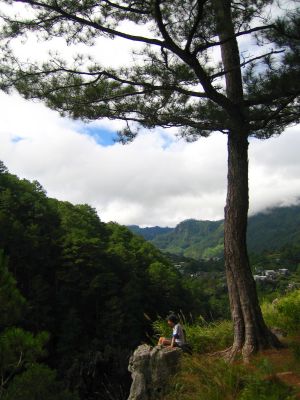 echo valley senti mode
 Ironwulf tinkering with his shutters
 at Lumiang cave
  for whom the old bell tolled?
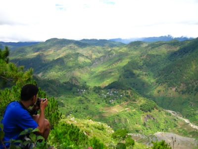 Ironwulf admiring view of Kiltepan
 Bomod-ok: the big falls
 hanging coffins of Echo valley
 The Skull, the one we found in Echo Valley where we also met Manny, another co-moderator of Explore Philippines yahoogroups. Ferdz even re-arranged the skull to have a better "pose" ;)

 the tilapia- a prized find high up in the mountains
Travel Information:
Sights to see: Hanging Coffins, Bomod-ok Falls, Sumaguing Cave, Lumiang Cave, Kiltepan Rice Terraces, Lake Danum, Echo Valley,

Where to stay:
You can just drop in and inquire once you get there. You need reservations though on peak days. The hospital opens its doors to people without a place to stay.
How to get to Sagada:
Sagada can be reached in two ways: commute via Baguio for a 6 hour bus trip of Lizardo Trans at Dangwa Terminal passing through Halsema Highway; and via Banaue after a two hour jeepney ride.
Related Posts:
Sagada Festival of Lights, Bontoc
Labels: Caves, Cordillera, Cordillera Administrative Region, Mountain Province, Sagada, Waterfalls
posted by GingGoy @ 7:25 PM,
,
Bulacan: The Historic Biak-na-bato Caves: A disaster Waiting to Happen
25 October 2006
Visiting the historic Biak-na-bato was foremost in my mind; this opportunity would make me fulfill that wish for free.
My friends and I arrived at the Bulacan provincial capitol in Malolos just a few minutes off the announced time but it turned out we had to wait, as always, for the other participants and organizers to show up. We expected a battalion of photographers but it turned out the organizers lacked the information drive so was only able to reach a handful of people.
After almost 2 hours of waiting, we, numbering around 22, were herded into vans that transported us to San Miguel town we found out are so far from the capitol and encountered traffic along the way and passed by fields and unpaved road going to the national park used as a hideout and camp of Gen. Emilio Aguinaldo during the Filipino-American war.
Arriving at Biak-na-bato, we were briefed by the organizers about the trip and divided us into groups according to our preferences on where to go and take pictures. I readily noticed the guides' "brilliance" in estimating distances since they always talk hundreds of kilometers to trek towards certain destinations which only superman can cover in a matter of minutes or seconds. Being human has it's limitations; the guides should've studied the true distances only a few kilometers instead of hundreds.
We first toured the park leading to a bridge, streams, pahingahan cave (resting place in Filipino) and Bahay Paniki (house of bats). Guides kept on telling stories of the cave where Gen. Aguinaldo allegedly signed the Treaty of Biak-na-bato in 1897. Such claims by the guides were erroneous since the treaty was never signed in those caves but in a hut outside the caves. The caves merely sheltered the Katipunan, whose various chambers and passageways, forming a labyrinth, is a deathtrap for any unsuspecting enemy to enter.
Biak-na-bato treaty provided for the surrender of Gen Aguinaldo and his followers, amnesty for those who joined the rebellion, plus pocket money to be exiled to Hong Kong. But even after signing the treaty, the rebellion didn't stop, fighting continued and the money paid by the Spanish government were spent to buy arms. The war continued at such an opportune time when the Americans came with the ships of Dewey...the rest was history.
What picqued me on seeing the historic park was the government's disregard of the ecological disaster waiting to happen when quarrying was allowed, despite it being declared a protected national park. The following pictures will tell you why:

vandals violating sacred place
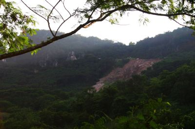
the desecrated side of Mt. Manalmon blasted away by dynamite in search of the precious marble

a river runs thorough it
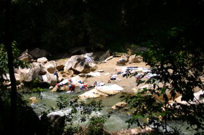
aren't people supposed to stay out of protected reserve? even washing their clothes can ruin the water...tsk...tsk...tsk

a shoud've been nice photo if not for the bad lighting :(

the bat cave. wait until 5pm for the friends of the Dark Knight to come out
Continued here.
Bulacan Resorts
Labels: Bulacan, Caves, Central Luzon, Emilio Aguinaldo, Filipino-American War, History, National Parks
posted by GingGoy @ 8:44 PM,
,
Banahaw Trek
07 September 2006
part of the Kinabuhayan Cafe package and photography seminar is a light trek to Mt Banahaw's green slopes, streams, and caves. A short jeepney ride to the jump off point will pass by numerous churches and shrines by groups (avoid to call them cults for political correctness) believing in the mysticism of the mountain.
 First stop is Dolores where more than a hundred concrete steps that i didn't bother to count leading down to a stream below but along the way you'll encounter an image of Sta Lucia where you're requested to light a candle and say a short prayer.
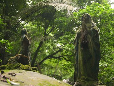
Another icon you'll see hundred steps further down before we reached the end of the steps where images of the Holy Family and of Mary and a genuflected child (shown below) perched on a large rock against a backdrop of mystic mountain's lush foliage including ferns.
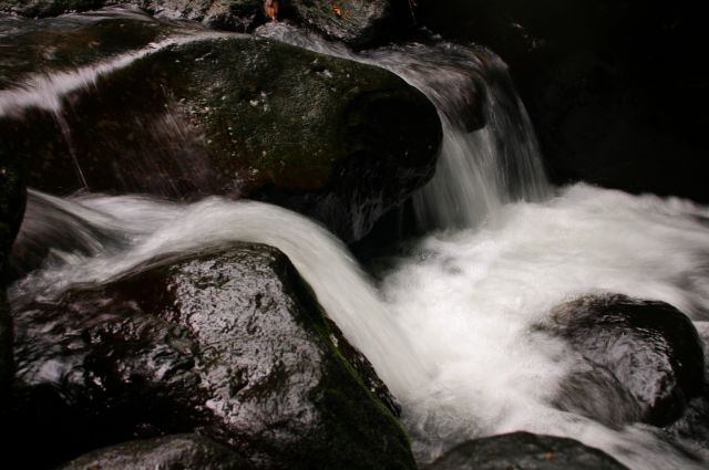
 the stream and small waterfalls below (the truth is i expected a larger falls than the one I saw so a bit disappointed, that's what you get for such "great expectations"). I also don't like concrete steps on mountains for I prefer unspoiled and pristine off the beaten track places but that's just me.
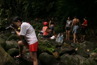

going back up after taking photos and getting drenched and refreshed wasn't easy to some of us and we proceeded to another place locals call Jacob's well
 which is a small cave with an opening suited for horizontally-challenged or non-claustrophobic individuals. Inside the cave is a cramped chamber and pool of water where people take a refreshing dip seven times that locals believe would wash away their sins (not that i believe such claims but i respect them and not say a word). It was probably named Jacob's well due to the presence of a ladder in the pool akin to Jacob's ladder in the Bible. Anyway, i should've dipped much more than seven times since it's really refreshing and more efficacious than Dr Wong's and Dr Kaufmann's sulphur soap!
(picture shown lacks scale since i forgot to include people but the cave entrance can really make "healthy" people squirm and wiggle through the narrow crevices of the cave)
the trail back to the jeep again we saw stalls selling various talismans, amulets with the all familiar eye enclosed by an equilateral triangle symbol, souvenirs, food including sweet bukayo, and things that looked like stalactites and stalagmites blasted from the caves by unscrupulous individuals looking for quick cash to the detriment of the environment that they should be looking after.
Mt Banahaw is a nice place to visit and re-visit (and re-visit) and perhaps because i wasn't able to see and take pictures of my enigmatic namesake, the tutubi, that JB informed me of. Maybe next time.
to be concluded...
Related Posts:
Kinabuhayan Cafe Gateway to Mt Banahaw, Kinabuhayan Cafe Day 2
Labels: Calabarzon, Caves, Mountains, Quezon, Southern Tagalog, Spelunking, Trekking, Waterfalls
posted by GingGoy @ 10:46 AM,
,