Tagaytay Picnic Grove Entrance Fee, Rates, Map, How to Get there
02 February 2014
UPDATED January 2016
Picnic Grove Admission Rates and Fees:
Entrance fee: PhP50.00/head (4 years and old and above)
Parking fee:
Car PhP35.00
Van PhP50.00
Coaster PhP50.00
Jeep PhP50.00
Bus PhP100.00
Rental Rates:
Table PhP100
Picnic Huts PhP150.00
Family Sheds PhP300.00
Pavilion PhP500.00
Viewdeck Hall PhP2,500.00
Fish Spa PhP199.00 one hour
Horseback Ride:
How to get to People's Park in the Sky Tagaytay:
Please refer to this How to Get to Tagaytay post for detailed directions.
Tagaytay Zipline Rates: PhP100.00 (weekday) PhP200.00 weekend/holiday

No information on Picnic Grove telephone contact numbers or official website for inquiries
Related Posts on Tagaytay:
Directions to Tagaytay
Sky Ranch Tagaytay
Labels: Metro Tagaytay, Parks, Tagaytay City
posted by GingGoy @ 9:10 PM,
,


Tagaytay: People's Park in the Sky Entrance Fee, Rates, Map and How to Get there
18 January 2014
UPDATED January 2016

People's Park in the Sky Admission Rates and Fees:
Entrance fee: PhP30.00/head
Conference Hall rental: PhP2,500.00/day
View Deck (whole day): PhP800.00
View Deck (half-day): PhP500.00
Amphitheater (one day): PhP1,500.00
Amphitheater (half-day): PhP700.00
Picnic Huts rental rates: PhP100.00/day
How to get to People's Park in the Sky Tagaytay:
Please refer to this How to Get to Tagaytay post for detailed directions.

No information on People's Park in the Sky telephone contact number or official website for inquiries
Review:
People's Park in the Sky is a government-owned park that is actually not well maintained. The landscaping needs to be improved even with simple cleanliness. It does offer a different view of Taal Lake and Taal Volcano. If you have your own vehicle, you can't drive inside the park, you need to ride a jeepney to take you to the view deck, it's quite a long walk, please be forewarned :P
Related Posts on Tagaytay:
How to Get to Tagaytay
Sky Ranch Tagaytay
Tagaytay Zipline
Labels: Metro Tagaytay, Parks, Tagaytay City
posted by GingGoy @ 9:25 PM,
,
Gabriela Silang Park, Santa, Ilocos Sur (Northern Luzon Heroes Hill National Park)
20 September 2011
Just along the national highway in the town of Santa, Tutubi chanced upon a billboard marking the historic pass occupied by Ilocano fighters under the command of Diego Silang, then later succeeded by his wife Gabriela.
Gabriela Silang Park occupies a strategic location overlooking the sea on a promontory, beside Imelda Park (yeah, listed as a tourist attraction in Ilocos Sur website but actually badly maintained with very few people, mostly locals, present).
What can you see in Gabriela Silang Memorial Park? Just a billboard, empty tables and benches for picnics, there's Imelda Park, also with picnic tables (mostly empty), beach nearby, huge trees (probably centuries old or at least heritage ones 50 years or more) and across the highway is Northern Luzon Heroes Hill National Park


a marker nearby states (in Filipino): "dating Pideg at ginawang Diego - Gabriela Silang noong 1976. Ipinagawa ng mga Pransiskano noong 1600. Ginamit noong 1600 sa pag-aalsa nina Andres Malong at nina Diego at Gabriela noong 1762 pagkamatay ni Diego noong May 28, 1763. Ang pag-aalsa ay pinamunuan ni Gabriela, pagkaraan ng ilang sagupaan as sinalakay ng mga kastila and pasong ito. Nadakip si Gabriela at ipinabitay noong setyemre 20, 1763"
The Gabriela Silang Monument near the entrance of Imelda Park (in silhouette) due to late afternoon stop by Tutubi, with the heroine astride on a horse.

 the Gabriela Silang Monument at Gabriela Silang Carpark at the corner of Makati Avenue and Ayala Avenue, Makati City
Have you ever wondered if it's really correct to depict Gabriela Silang on a horse with two feet off the ground? Monuments with persons on a horse have meanings :P
---
Location: Santa, Ilocos Sur
GPS Coordinates: N17 27 53.0 E120 26 06.2
Labels: Ilocos Region, Ilocos Sur, National Heroes, Parks, Philippine History
posted by GingGoy @ 8:42 PM,
,
The "Evergreen" Japanese Garden in Cavinti, Laguna
07 September 2010
On entering the place, you'll notice towering trees (a delightful treat to biologists and nature lovers alike) and wide spaces of green grass ideal as picnic areas. There are also cottages (no rental fees), restrooms and a snack counter, a man-made lagoon (that used to have kois and goldfish years ago). For those going on a picnic, food is allowed to be taken in but be sure to not leave your trash behind (as it should always be).
 the man-made lagoon that used to be populated with kois with torii-like bridge that connects to the long stairway

 it's a walk in the park for this kid and 2 ladies
 the hilltop provides a good photo opportunity much better if there's a blue sky. the top of the hill offers a great vantage point for viewing the twin lakes of Caliraya and Lake Lumot while savoring country fresh air
 the view of Lake Caliraya on the hilltop
Inside the Japanese Garden is a shrine constructed by Philippine-Japan Friendship Society in memory of the Japanese soldiers who perished in the battle during World War II between the Japanese and Filipino-American troops. (Tutubi overheard a local mentioning Gen. Tomoyuki Yamashita held camp at the garden wile on another occasion also heard Yamashita and the fabled Yamashita Treasures were buried there. Such rumors still persists!
 the Japanese memorial to fallen soldiers of World War II...no mention of Gen. Yamashita (as Tutubi can recognize Yamashita in Nihongo/Kanji if it's written on the historical markers)
In truth, Gen. Yamashita used the mountains of the Cordilleras to defend against the combined forces of the Americans and Filipinos (and some Australians though largely ignored by history); surrendered in the town of Kiangan, Ifugao; tried by a kangaroo court of Gen. MacArthur, convicted for war crimes he didn't commit, hanged and buried somewhere in Los Banos, Laguna near UPLB and Bureau of Plant Industry. The site is now called Homma-Yamashita Shrine and is the subject of a future Tutubi exploration. The "Tiger of Malaya" is now enshrined at the infamous Yasukuni Shrine in Tokyo.
Lastly, this Japanese garden won't be complete without the iconic torii (鳥居・鳥栖・鶏栖)-- the traditional Japanese gate common in Shinto Shrines and Japanese Buddhist temples.
 one of two torii inside the Japanese Garden
 ---
For those wishing to visit the Japanese Garden
Japanese Garden Entrance Fee:
P10.00 for adults (including employees of NAPOCOR)
P5.00 for children
How to get to Japanese Garden, Cavinti, Laguna:
From Quezon City, the fastest route to Japanese Garden is via Rizal province and Manila East Road that'll take you to breathtaking views of Rizal province's "bitukang manok,"the city of Antipolo (via Sumulong Highway) and towns of Teresa, Morong, Baras, Tanay, Pililla, and the Laguna towns of Mabitac, Famy, Siniloan, Pangil, Pakil, Paete, Kalayaan and Lumban. In Lumban, you need to turn left when you see the kilometer 95 marker then go up Caliraya-Cavinti Road where Japanese Garden is located. Travel time via this route is around 3 hours from Trinoma/SM City North EDSA.
From Makati, you can take SLEX Calamba exit then turn right at Calamba Crossing (unless you know the bypass road in Real up to Halang to avoid traffic) then drive all the way to Lumban to kilometer 95 marker. Follow the upward road til you see the Japanese Garden sign to your right.
Commute to Japanese Garden? It's not really easy and reliable but possible to get there via Sta. Cruz, Laguna where you can ride jeepneys plying the Sta. Cruz - Lumot route (look for the signboard Lumot, refers to Lake Lumot and Lumot, Cavinti)
Other attraction: Lake Caliraya, Lumot Lake and the so called Magnetic Hill near the kilometer 98 marker. The Japanese Garden is said to be the drop off point for the one hour trek to the secluded Twin Falls of Cavinti but the waterfalls but is located in a private property so no effort is made to verify the claims of locals.
Related Posts:
Caliraya Lake Resort
Bus to Sta. Cruz, Laguna
Exotikk Restaurant
Labels: Calabarzon, Laguna, Parks, Southern Tagalog, World War II
posted by GingGoy @ 10:32 PM,
,
Leyte: Veterans Park and the Battle of Ormoc Bay
05 November 2008
 Ormoc Bay with Cebu Ferries waiting to leave for Cebu at 2pm every Monday and Wednesday at Ormoc City pier. Cebu ferries services Ormocanos taking them to Cebu, Dumaguete, Iligan, Jagna (Bohol), Nasipit and Ozamis.

 the Veterans Monument in front of Ormoc City Superdome
 A colorful monument to the guerillas during the war, the guerilla warfare forces, near the Veterans Monument in front of Ormoc City Superdome.
Ormoc Bay was the site of the historic Battle of Ormoc Bay in November 1944, just a few days after the Battle of Leyte Gulf began. It was on Ormoc Bay where Gen. Tomoyuki Yamashita sent reinforcements to Leyte against Gen. Douglas MacArthur's army who had landed on Red Beach in Palo town on October 20, 1944 (the same day when the first Kamikaze strikes were launched from Pampanga), ten days after Yamashita arrived in the Philippines and assumed responsibility of the defense of the Philippines.
With the defeat of the Japanese in The Battle of Leyte Gulf and the succeeding Battle of Ormoc Bay, Allied forces affirmed control of Leyte. From there, they launched attacks re-claiming other islands before the the disastrous Battle for Manila in February 1945, when Manila was leveled to the ground by American carpet-bombing on the (unnecessary) order of Gen. Douglas MacArthur combined with Japanese demolition.
On World War II Veterans:
Filipinos fought side-by-side with Americans during the war against the Japanese juggernaut. After the war, the Americans promised help, including US citizenships, to their brothers-in-arms, but the promises were never fully fulfilled. War veterans today are very old, sickly and dying one after the other without the promised aid...some were given but never enough to commensurate to the sacrifice and hardships they endured.
To Uncle Sam: Cuando, cuando, cuando?
Labels: Eastern Visayas, Leyte, Ormoc, Parks, World War II
posted by GingGoy @ 9:15 PM,
,
Jardin Maria Clara Lobregat in Pasonanca
11 March 2008
 the sign in front of the garden
 the gumamela, or hibiscus, incidentally, is the national flower of Malaysia
 a lantana, common in exotic butterfly gardens as source of nectar
 a black butterfly called Common Mormon (not sure though, have to confirm with local butterfly watching enthusiasts)
Note: Entrance fee to park and the butterfly garden: Free!
All photos taken using Canon 300D either with kit lens or 50mm...
Labels: Butterfly Garden, Flowers, Parks, Zamboanga City, Zamboanga Peninsula
posted by GingGoy @ 9:35 PM,
,
The "Lost" Sheep of Camp Atilano
06 March 2008
Pictures of Camp Atilano:
 the tree house you'll often see on Zamboanga City's tourism brochures
 inside the camp were flocks of sheep without a shepherd
 The lost sheep of Camp Atilano with tents looking like tepees in the background
After the brief photo opportunity, walked forward to the public swimming pool and serendipitously stumbled on a beautiful corner of the park: Jardin Maria Clara Lobregat.
To be Continued...
---
Park Entrance Free: None (as in Free)
How to get to Pasonanca Park:
Commute: At city center (called Pueblo) board a jeepney with Pasonanca signboard.
Labels: Parks, Zamboanga City, Zamboanga Peninsula
posted by GingGoy @ 9:45 PM,
,
Something More About Paete
10 January 2007

Wawa park before sunset

sunset over Rizal Province and Laguna de Bay. This picture is also the one used by the heartwarming slideshow A Parent's Wish available here.

View of Paete town, the tail-end is where Wawa Park is located.

The Three Crosses standing on top of the hill of the Sierra Madre overlooking the town and acting as shield against typhoons coming from the Pacific Ocean and Quezon Province
The 3 Crosses can be reached via a 45 minute trek through concrete steps from the town proper. Descent takes only about 15 minutes. "Over the hill" people can however reach the summit on a vehicle via a feeder road winding through the barrio of San Antonio, Kalayaan town.
On your way to the summit, you will also pass by this lagoon carved out by a waterfall feeding the rivulet that runs through the center of the town

Labels: Calabarzon, Laguna, Paete, Parks, Sierra Madre, Southern Tagalog, Waterfalls
posted by GingGoy @ 9:33 PM,
,
Jose Rizal: In Memoriam at Paco Cemetery and Luneta Park, Manila
30 December 2006
Let me share these two photos I took from my recent "11 hour unplanned" trip:

The Spaniards furtively buried JR in this unmarked grave without proper Christian rites. It was Rizal's sister, Narcisa, who searched for a freshly dug grave in Manila and found this one with guards stationed at the gate and beside the unmarked grave. Narcisa gave gifts to the guards and marked the grave RPJ.
A heated debate on Rizal's retraction continues up to this day.

It was only during the time of the American colonizers, who installed Jose Rizal as national hero allegedly for his pacifist views, that Rizals remains were transferred to the present Rizal Monument.
How to get to Paco Park, Manila:
Paco Park entrance fee: PhP5.00
Commute: Jeepneys plyig Taft avenue pass by Padre Faura St where Paco Park in at one end. The nearest LRT station is UN Avenue.
Driving Directions: the park is at the corner of Padre Faura St and San Marcelino. Note San Marcelino is a one-way street. The best access route is via UN Avenue coming from Taft Avenue or Nagtahan Bridge.
Labels: Cemeteries, History, Jose Rizal, Manila, Metro Manila, National Capital Region, National Heroes, Parks
posted by GingGoy @ 9:26 PM,
,
Manila: Walking Tour of Luneta (Rizal Park) and Baywalk
16 December 2006
The sun's already setting by this this time making taking pictures more enjoyable due to the lighting evidenced by the photo of Lapulapu (the rear guard of Jose Rizal) with children included to add scale.

nearing the time of the golden sun, we pushed forward to baywalk by hailing a cab to catch the famous sunset (that I never got tired of) where we saw the QTV event and a bunch of photographers (probably a class)


the former Arsenic mayor of Manila sitting on the bench
next, we experimented again with long exposure using the posts at the middle of Roxas blvd as tripod since both of us were too lazy to bring our own tripods. We couldn't get a better perspective as a result of our "indolence."


after 11 hours of walking, cab/jeepney rides and taking pictures, we decided to go home tired and weary yet satisfied with our "historic" journey most Filipinos would not even dare do.
Below is a map of Manila and the route we took from Quiapo to Baywalk

thus ended the tour of the flightless tutubi!
Labels: Manila, Metro Manila, Monuments, National Capital Region, National Heroes, Parks
posted by GingGoy @ 6:18 PM,
,
Manila: Paco Park, Paco Cemetery and St. Pancratius Chapel
15 December 2006
We rode a jeepney to take us to UN Avenue and hailed a cab since I don't remember where exactly was the cemetery (this is unplanned remember?) and shortly found out it's just a walking distance from there exactly at the corner of Padre Faura and General Luna.
The former cemetery, built in the early 19th century to accommodate the dead of a cholera epidemic of the time, with its two walled design, is now a charming venue for weddings and concerts. There's actually a wedding taking place inside the quiant Pancratius chapel when we arrived with the reception also with a garden setting cum the romantic multi-colored fountain at the center of the cemetery turned park.

St. Pancratius Chapel

the niches, mostly now empty

This place is of great historical importance due to the little known fact that Jose Rizal was buried surreptitiously here after his execution and his remains were only transferred to the present Rizal monument at the Luneta when the Americans came.
Another notable fact is that the remains of the 3 martyred priests: Burgos, Gomez and Zamorra, garrotted in 1872, were also secretly interred here.
How to get to Paco Cemetery, Manila:
The park can be reached on foot, a mere 400 meters or so, from Taft Ave coming from Padre Faura. The nearest LRT station is UN Avenue. Paco Park entrance fee is only PhP5.00. Taking pictures/photography is not allowed unless with special permit. Weddings at Paco Park, please get in touch with paco park administration by visiting their officieal website or calling contact number
Labels: Cemeteries, Churches, History, Jose Rizal, Manila, Metro Manila, National Capital Region, National Heroes, Parks
posted by GingGoy @ 7:25 PM,
,
More (but Lousy) La Mesa Pictures
06 June 2006

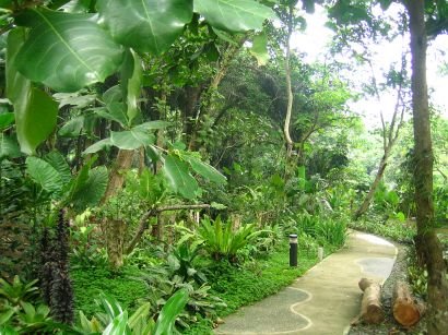
a walk in the park

picnic in the ampitheater



lousiest photo here due to bad lighting but only to show the wall climbing area.
It's not really a good time to take pictures since it's high noon where harsh shadows and pockets of bright sunlight show up on your subject. I don't have the luxury of time to wait till sundown also. Next time I'll bring my other bulky camera.
Labels: Metro Manila, National Capital Region, Parks, Quezon City
posted by GingGoy @ 6:17 PM,
,